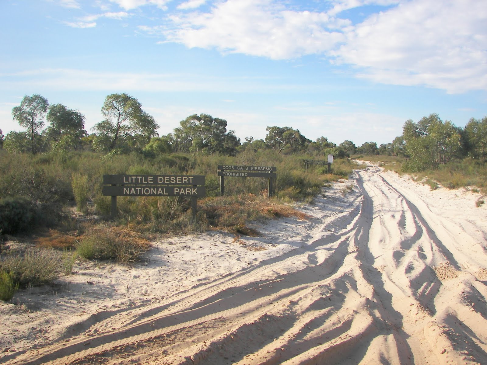
Mt Skene & Mt Terrible
DAY 1 – FRIDAY 22
We left South Morang at 5:05pm with Jacko – Vicki, Sarah and Jacob, Brady – Reece, Jason – Kerry, Mark, Rob – Jessica and Bec. Geoff met us at Mansfield,as he was about 15-20 minutes behind us on Plenty road.
We stopped at Mansfield BP for dinner; others went into town for stir-fry. We arrived at Jamieson about 8:15pm.
We got organised into our rooms, and then went down to the pub to have a drink and talk.
DAY 2 – SATURDAY 23
We met the rest of the group in Jamieson in the morning. Now we were a group of 10 cars including: Jacko – Vicki, Sarah and Jacob, Brenton – Jasmine, Jason – Kerry, Mark, Ian, Brady – Reece, Mitch – Tara, Geoff, Rob – Bec and Jessica, Norbet – Lisa and Renee
We left Jamieson about 8:10am. Our first leg of the trip was in the wrong direction and after turning round we were off in the right direction.
On the way up we spread out slightly, and through the hills sometimes had communication issues, but all was well. We aired down the tires on the side of the road as the ride was a little too rough.
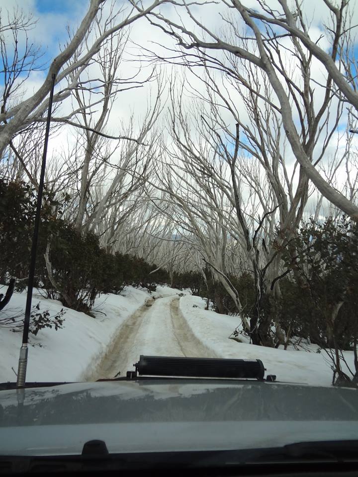
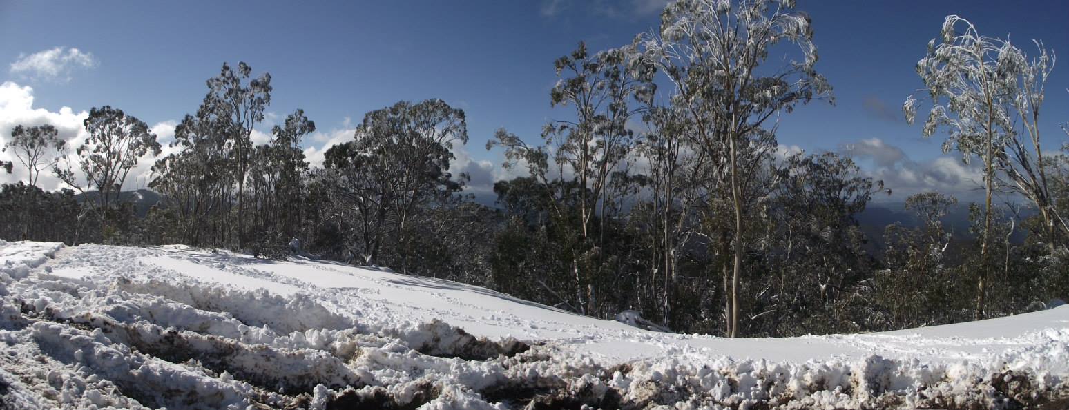
We passed no one on the way up, and we weren’t sure there was going to be any snow, but we were in luck. At the first sight of it we stopped for a photo.
As we climbed higher there was more snow.
Just before we got to the summit there was a lookout/picnic area where we went for a little bit of a play. There were two bog holes, not too bad, and we had fun splashing the camera people.
After throwing a few snowballs and slipping on the icy bits we continued further. We then made our way to the summit, going sideways a few times through the snow.
It was time to get the toboggans out. Jacob and I tried several different places and had fun steering past trees. We had a failed attempt at a snowman due to the icy snow, and then a walk to the summit, posing for a photo, on the marker. We then began a snowball fight; I don’t think anyone was spared. After walking back we returned the toboggans to Norbet.
We drove off, passing a group of three who had pulled up while we were talking and planning the next route. We travelled along the main road down the other side of the mountain (down a side track), and then back on the main road passing a group of 4 vehicles.
Continuing along the road we found that there were many trees fallen down. One had been cut up but it was massive (at least 2 feet in diameter). The cut was very narrow and we had to squeeze through. Just after the tree we saw a group of 7 vehicles – a portion of the 100 that could have a permit for Mt Skene.
Travelling further, we passed our turnoff to N15 Champion Spur Track, and were a bit confused as two tracks seemed to have the same entrance, but we were okay in the end and found the entrance to N15 Champion Spur Track.
Travelling down the track we met a group of hunters who had set up camp on the side of the road. They explained that the road was blocked and one of their group was working on it, but he only had a tiny chainsaw and was taking a while to cut through the tree. We got a few chainsaws out and made short work of it.
Geoff explained he had been down here before and it was narrow, very narrow. It had been okay so far so we weren’t sure. Then it got A LOT narrower, and many bush pinstripes were earned.
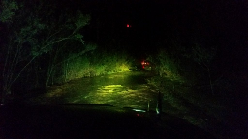
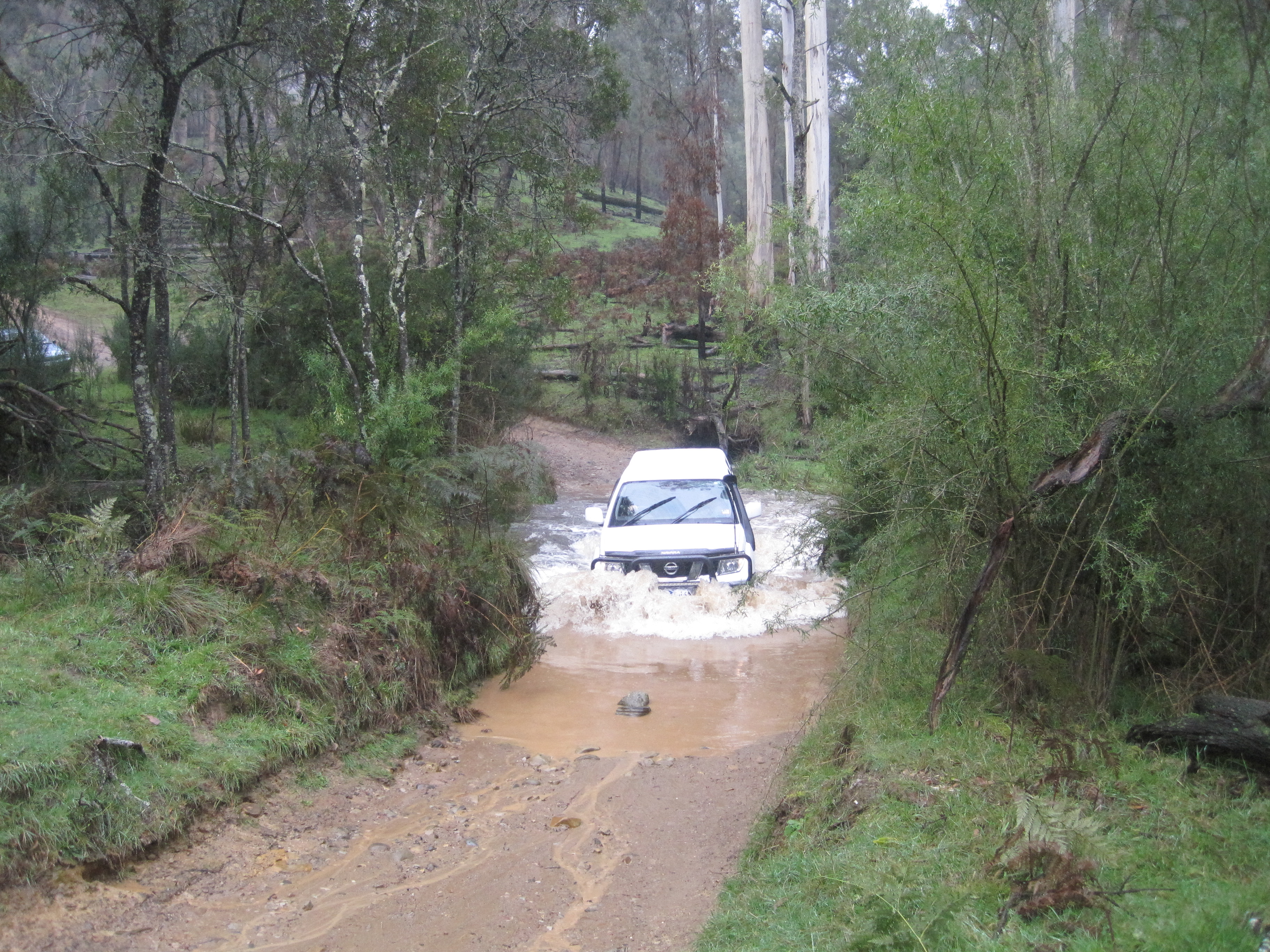
There were steep downhill sections with Jacko and Mark scraping along the ground a bit. As we made our way down to the river we were greeted by the sight of a tree across the river, so we stopped for lunch before we had to decide if we should move it or work out if the turn off was just before the tree. While we were stopped Rob and Renee crossed the river and trekked through the bush a little to find the exit. They decided we wouldn’t have to cut the tree, as the turn off was before the tree.
As trip leader Jacko went first, having to gain momentum to get out just after the lip from the river, and then taking several bites at the next slope and on to a level area. After us was Brenton and then Jason, who both got out without too much fuss. Mark had the lowest clearance and after making out of the river itself, was stuck, his rear diff dragging on the ground. Jason returned back down and snatched him up after a few tries, at one stage pulling him sideways because he was stuck at a corner. We feared the wheel could be pulled off. All the others made it up the only evidence of struggle the long dent between the ruts from Mark’s diff.
We continued along with the track closing up again and collected many more pinstripes. A few slippery corners later and with some steep rocky tracks ahead of us we thought Mark would have to be snatched again. However he made it up OK. Meanwhile Jacko was having a challenging drive through this area.
The bush closed in further, the most it had all day, even walking ahead to cut several of the massive trees you had to duck. After pulling branches aside and cutting bigger trees, we finally made it to an intersection, and off N15 Champion Spur Track.
Driving down this track we made it back to a main road, finally out of the trees. By this time it was 4:15, too late to get to Woods Point. So we headed down Mt Selma road to South Road and Hayfield Jamieson Road instead.
On the way back to the Mt Skene summit it was slippery; with Brenton going sideways and consequently getting stuck. Jason started to dig out his tires saying it should increase his traction. It did, and as we continued on it came to sunset. As we moved from the snow it became darker, and the dust became a nuisance. Just before we got back to Jamieson we saw a sign: trees close to road, I think that they didn’t know what they were talking about.
Making it back to the pub at about 7 we put our stuff in our rooms, and ordered dinner. Jacko bought some drinks for everyone because of the pin striping… We made a plan to leave at 9 the next morning while people chatted and then went to bed.
DAY 3 – SUNDAY 24
Leaving for today’s trip we only had 5 cars, as Brenton, Ian, Brady, Mitch and Mark were going to head home.
We set out towards Mt Terrible, turning onto Polletti track. We headed up the steady incline and it became obvious we’d made a good decision. The slightly slippery surface, and steady but steep incline made for good driving. We had to stop a few times on the way as Jacko’s auto (gearbox) was getting very hot.
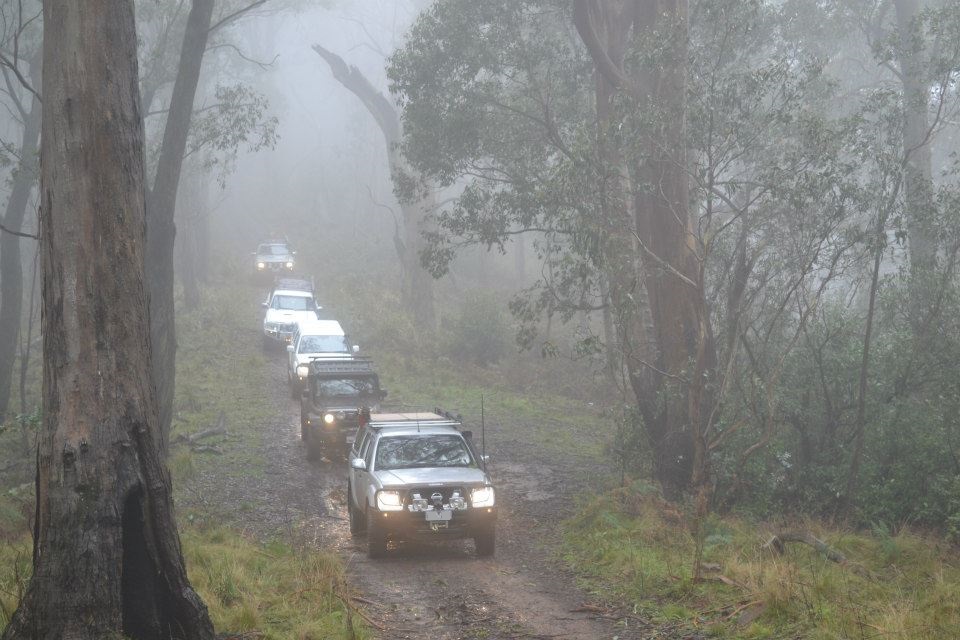
With several forks and two options over steeper, rougher tracks we eventually made our way to the summit. Surrounded by fog, it was hard to see the track and the view….
Rob told us his coolant leak had gotten worse, it was in one of the back pipes, harder to fix. With this in mind we decided to head back to bitumen, and lunch….
We went down the way we came and then took Fryers Creek track towards the Eildon Jamieson road. This was a good track, not too steep, sometimes slightly narrow, with interesting foliage, and trees that had been cut out of the way. It was almost too narrow. After one stage of spotting Jacko through we were okay, only occasionally having to move branches.
Once we were on the bitumen we crossed to a parking area and pumped the tires back up and then stopped at the campsites for lunch.
The river was amazingly clear and this was where the trip officially ended. Most of us stuck together on the way out and Renee had a turn behind the wheel. After saying bye over the radio we headed home.
Sarah